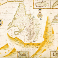
A chart of the coasts of Newfoundland, with the fishing districts marked
Dublin Core
Title
A chart of the coasts of Newfoundland, with the fishing districts marked
Subject
"by Augustine Fitzhughe, living next doare to the Shipp in Virgine Street, anno 1693"
Description
The growing intensity of political rivalry concerning fisheries was epitomised in this heavily detailed manuscript map of 1693. Not a great deal is known about its maker, Augustine Fitzhugh, but it has been established that he had served as an apprentice to John Thornton who was renowned for The English Pilot series of maps and thus probably well versed in distinguishing features such as anchorages, soundings, and navigational hazards.
Indeed, the utility and stylistics of the map accord with what has been identified as the Thames School of cartography. Adorned by two elaborate compass-roses it adapts some portolan style features, in that the more important place names of towns, or hazards, are written in red in contrast to more minor place-names in black. While depicting navigational information and explicitly indicative of the economic significance of the Grand Banks fisheries, this chart politicizes the fishery by differentiating the French and English fishing fleets. It contrasts the French fleet on the Grand Banks with English boats fishing closer to shore - thus supporting the contention that the English fishery was more of an inshore industry than one based on the actual banks - and at the same time implying a perceived imminent threat posed by French interests to England's fisheries.
A legend 'The English Fishing Boats' stretches between two flags ('The King's Colours' or Great Union Flag) that extends from Cape Race to the Bay of Foggs. This has the effect of enclosing a tightly compacted fleet of boats, mostly comprised of small fishing craft, variably double or treble crewed and with nets being cast. Similarly, the shore is inscribed with toponyms with the Avalon peninsula edged in pink that continues northward to the Bay of Foggs. Smaller British flags punctuate the eastern shore alongside established harbours that are also separately shown in insets at the top and bottom of the entire map. In close attendance are two large naval vessels with red ensigns. Shore-based crews had to row as much as three or four miles daily, mooring their vessels as much as a half-mile offshore in water to forty fathoms deep. The stretch from the Avalon peninsula to Trinity Bay is rendered fairly accurately and tightly inscribed with place names, reflecting the coast with which the English would have been most familiar.
All of the banks depicted are shown in a dark yellow hue with the sections further from shore more differentiated in a lighter texture. Only 'The Maine Banck' and 'The False Banck' are actually named with the former containing 'Dry' areas to indicate shallower patches. Most of the banks are connected together to give a pincer appearance around the southern and eastern shores of Newfoundland effectively enveloping the English fishing fleet. The effect is amplified by the looser but more extensive formation of vessels accompanied by two inscriptions of the legend 'French Fishing Boats'.
The vast majority of French boats are proportionally larger and asymmetrical in construction than their 'English' counterparts as well as more frequently indicated to be single crewed or not crewed at all. Only occasional depictions of marine biota in the Banks are shown but they are difficult to identify with precision. The only clear illustration of fish are a pair of flatfish stylised to flank the scale cartouche. While the banks are interspersed with numeric soundings, none are given for the inshore Newfoundland fisheries bar in the harbour insets for Ferryland, St John's, Harbour Grace, and the Bay of Bulls, that also illustrate pilot guides to anchorage and fortifications flying the British flag. In the case of Ferryland, renderings of built settlement can be observed.
While containing a great deal of data, the map provides a fascinating snapshot in vividly juxtaposing the English and French fishing fleets during the time of King William's War (the North American theatre of the Nine Years' War (1688-97) - the first of a series of conflicts England and France waged until the late eighteenth century). The foreboding impression of the map was indeed realised in 1696 when the French sacked the English settlements of the Avalon peninsula.
Creator
Augustine Fitzhughe
Publisher
Trinity College Dublin
Date
1693
Contributor
Dr Kieran Rankin
Rights
Creative Commons
Relation
British Library
Format
JPEG
Language
English
Type
Map
Files
Citation
Augustine Fitzhughe, “A chart of the coasts of Newfoundland, with the fishing districts marked,” NorFish Platform: Databases & Cartography Hub, accessed December 30, 2024, http://cehresearch.org/norfishplatform/items/show/4.

