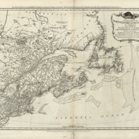
Cartographical Perspectives on the Evolution of Newfoundland's Grand Banks Fisheries in the Sixteenth, Seventeenth, and Eighteenth Centuries
Dublin Core
Title
Cartographical Perspectives on the Evolution of Newfoundland's Grand Banks Fisheries in the Sixteenth, Seventeenth, and Eighteenth Centuries
Subject
Maps charting the evolution of Newfoundland's Grand Banks Fisheries in the Sixteenth, Seventeenth, and Eighteenth Centuries.
Description
At the turn of the sixteenth century John Cabot and his successors discovered abundant fish stocks in the waters around Newfoundland. Through the subsequent two centuries, British, French, and Iberian fisheries developed in the Grand Banks region which had a transformative and globalising impact on commerce and inter-state politics across the North Atlantic. Contemporaneous maps of the period provide another strand of evidence that supplement our knowledge of these fisheries. We emphasise how select cartography of the sixteenth and seventeenth centuries rendered significant mutations and innovations in how such fisheries and adjacent waters were represented in physical and changing political contexts. We proceed to argue that a crucial innovation was the evolution of hydrographical indicators in maps of notable aesthetic appeal that would have had significant influence. We also demonstrate that more refined and accurate delineations of the Grand Banks shadowed the development of fishing activities that encompassed both Newfoundland's nearshore as well as the Grand Banks themselves.
Creator
Trinity Centre for Environmental Humanities
Publisher
The North Atlantic Fish Revolution - An Environmental History of the North Atlantic 1400-1700 (NorFish)
Date
2018
Contributor
Kieran Rankin, Trinity College Dublin
Rights
Creative Commons
Relation
cehresearch.org/norfish.html
Items in the Cartographical Perspectives on the Evolution of Newfoundland's Grand Banks Fisheries in the Sixteenth, Seventeenth, and Eighteenth Centuries Collection
Collection Tree
- Cartographical Perspectives on the Evolution of Newfoundland's Grand Banks Fisheries in the Sixteenth, Seventeenth, and Eighteenth Centuries
![[Carta del curso del río de San Lorenzo desde su desembocadura hasta el lago de Golesme] [Carta del curso del río de San Lorenzo desde su desembocadura hasta el lago de Golesme]](http://cehresearch.org/norfishplatform/files/square_thumbnails/b4c4d6f63d88d12e25bc57faa0f7b040.jpg)
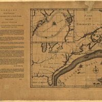
![[Franklin–Folger map] Remarques sur la navigation de terre-neuve à New-York afin d’eviter les courrants et les bas-fonds au sud de Nantuckett et du Banc de George [Franklin–Folger map] Remarques sur la navigation de terre-neuve à New-York afin d’eviter les courrants et les bas-fonds au sud de Nantuckett et du Banc de George](http://cehresearch.org/norfishplatform/files/square_thumbnails/22e9115c2ff062584299af7bda4071ba.jpg)
![Carte réduite des bancs et de l'île de Terre-Neuve [avec texte ms. sur les traités de 1713, 1763, 1783] Carte réduite des bancs et de l'île de Terre-Neuve [avec texte ms. sur les traités de 1713, 1763, 1783]](http://cehresearch.org/norfishplatform/files/square_thumbnails/7d9180c34ed6d4bc6656e6fc65f69436.jpg)
