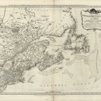
A general map of the northern British colonies in America. Which comprehends the province of Quebec, the government of Newfoundland, Nova-Scotia, New-England and New-York.
Dublin Core
Title
A general map of the northern British colonies in America. Which comprehends the province of Quebec, the government of Newfoundland, Nova-Scotia, New-England and New-York.
Subject
Cartography
Creator
Robert Sayer; John Bennett [Publishers]
Publisher
Library of Congress, United States
Date
1776
Identifier
http://hdl.loc.gov/loc.gmd/g3300.ar014300
Still Image Item Type Metadata
Original Format
Map
Physical Dimensions
48 x 67 cm
Files
Citation
Robert Sayer; John Bennett [Publishers], “A general map of the northern British colonies in America. Which comprehends the province of Quebec, the government of Newfoundland, Nova-Scotia, New-England and New-York. ,” NorFish Platform: Databases & Cartography Hub, accessed December 22, 2024, http://cehresearch.org/norfishplatform/items/show/95.

