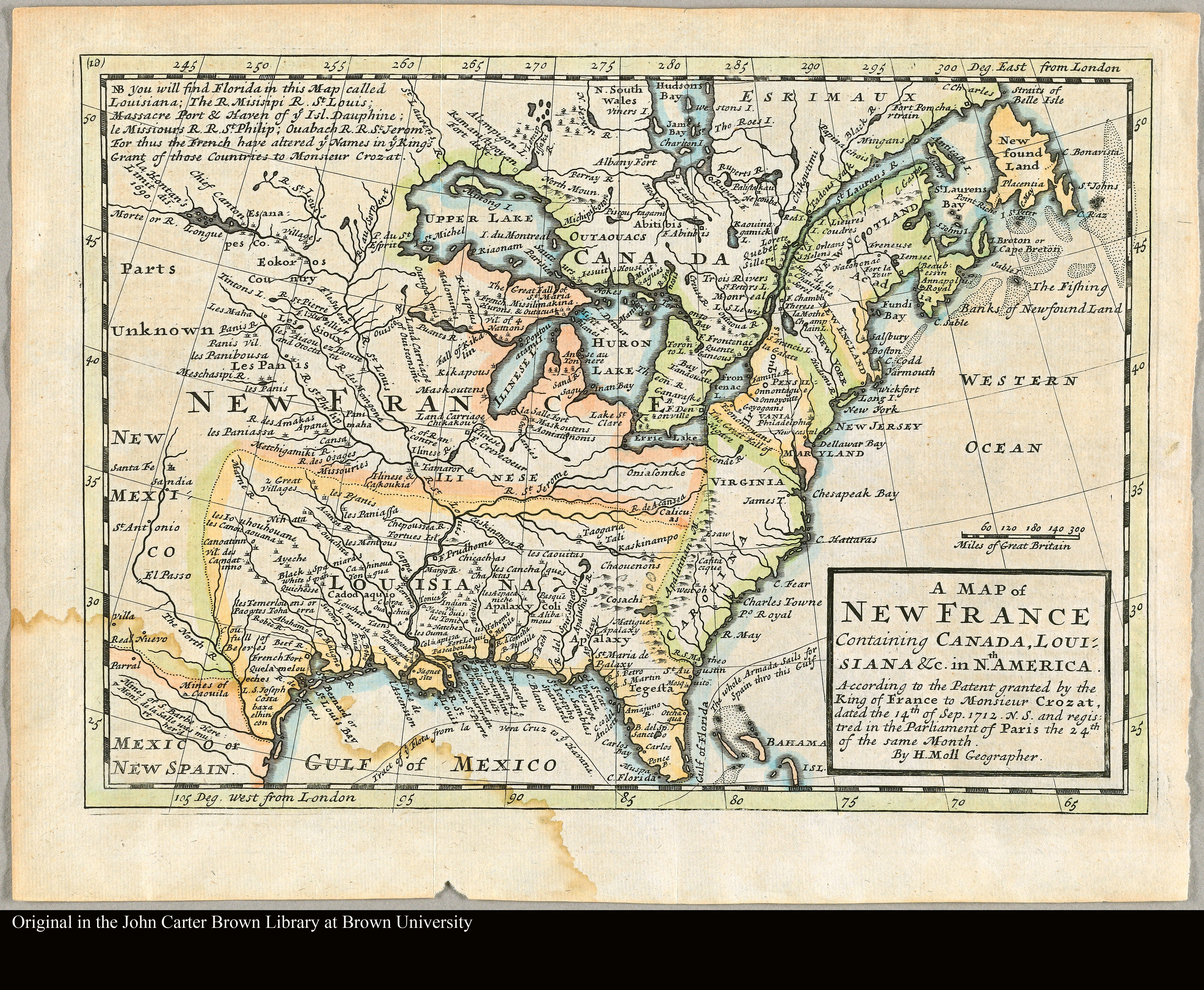
A map of New France containing Canada, Louisiana &c. in N[or]th. America according to the patent granted by the King of France to Monsieur Crozat, dated the 14th of Sep. 1712 n.s. and registered in the Parliament of Paris the 24th of the same month by H. Moll, geographer
Dublin Core
Title
A map of New France containing Canada, Louisiana &c. in N[or]th. America according to the patent granted by the King of France to Monsieur Crozat, dated the 14th of Sep. 1712 n.s. and registered in the Parliament of Paris the 24th of the same month by H. Moll, geographer
Subject
Cartography
Creator
Herman Moll
Publisher
John Carter Brown Library, United States
Date
1712
Identifier
File C713 MoH
Still Image Item Type Metadata
Original Format
Map
Physical Dimensions
19 x 26 cm
Files
Citation
Herman Moll, “A map of New France containing Canada, Louisiana &c. in N[or]th. America according to the patent granted by the King of France to Monsieur Crozat, dated the 14th of Sep. 1712 n.s. and registered in the Parliament of Paris the 24th of the same month by H. Moll, geographer,” NorFish Platform: Databases & Cartography Hub, accessed October 16, 2026, http://cehresearch.org/norfishplatform/items/show/74.